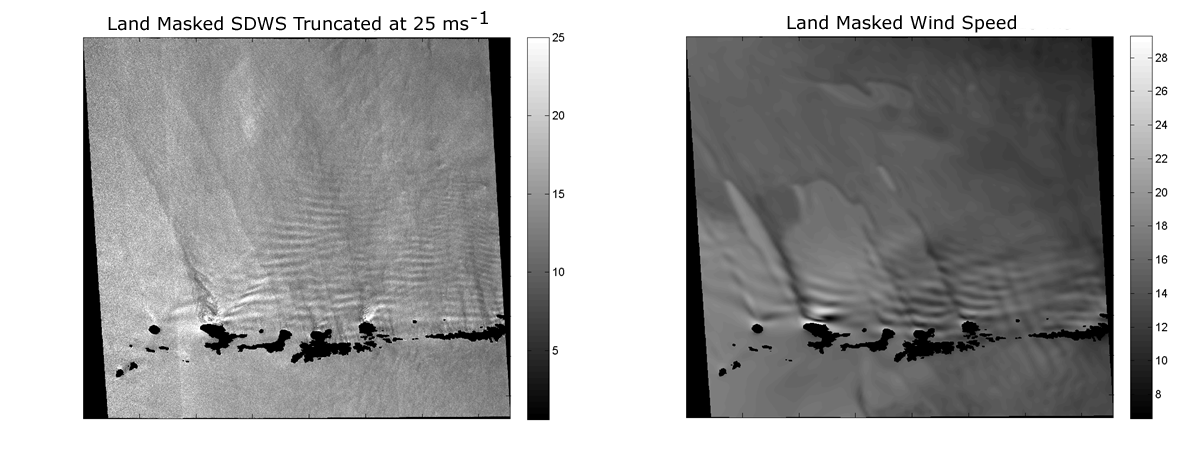
Left: Wind speed image derived from a Radarsat-1 HH-pol synthetic aperture radar image collected at 0532 UTC 26 January 2008. Wind speeds are shown in ms-1. The spatial resolution of the SDWS image is 250 m. The image is centered in the southern Bering Sea just north of the Aleutian Islands. The islands have been masked so that complex terrain would not be misinterpreted as wind patterns. The quasi-linear alternating pattern of high and low wind speeds oriented approximately parallel with the Aleutian Islands are the surface expressions of orographically induced atmospheric internal gravity waves. Right: Corresponding WRF 2-km grid domain surface wind speed in ms-1. For more information, see Winstead, N.S., G.S. Young, T.D. Sikora, 2012: Demonstration of the use of synthetic aperture radar-determined wind speed in numerical weather prediction error detection. Natl. Wea. Dig., 36, 69-80.